


Voting District 321, Choctaw County, Oklahoma
About
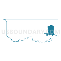
Outline

Summary
| Unique Area Identifier | 653694 |
| Name | Voting District 321 |
| County | Choctaw County |
| State | Oklahoma |
| Area (square miles) | 41.35 |
| Land Area (square miles) | 40.51 |
| Water Area (square miles) | 0.83 |
| % of Land Area | 97.98 |
| % of Water Area | 2.02 |
| Latitude of the Internal Point | 34.01389890 |
| Longtitude of the Internal Point | -95.27386980 |
Maps


Graphs
Select a template below for downloading or customizing gragh for Voting District 321, Choctaw County, Oklahoma


Neighbors
Neighoring Voting District (by Name) Neighboring Voting District on the Map
- Voting District 0017, Red River County, TX
- Voting District 210, Choctaw County, OK
- Voting District 211, Choctaw County, OK
- Voting District 319, Choctaw County, OK
- Voting District 320, Choctaw County, OK
- Voting District 322, Choctaw County, OK
Top 10 Neighboring County Subdivision (by Population) Neighboring County Subdivision on the Map
Top 10 Neighboring Place (by Population) Neighboring Place on the Map
Top 10 Neighboring Elementary School District (by Population) Neighboring Elementary School District on the Map
Top 10 Neighboring Unified School District (by Population) Neighboring Unified School District on the Map
- Hugo Public Schools, OK (7,763)
- Detroit Independent School District, TX (2,051)
- Fort Towson Public Schools, OK (1,996)